
TMG Yachts Cruising Guide to the Kimberley
TMG Yachts Cruising Guide Australia
Protected by its remoteness, there are very few sealed roads in the Kimberley, so the vast majority of its ancient landscape is only accessible by sea. Yes, it can be viewed at a distance from the air, but we think the only way to explore its nearly 13,000 kms of largely untouched coastline and thousands of tiny islands, is in person on your Lagoon catamaran.
And even though the Kimberley Coast has become an increasingly popular destination for cruise ships and charter boats, its sheer size and remoteness ensures that it still remains uncrowded and largely untouched – you may well go for days without seeing another boat!
It’s hard to narrow down a list of top places for this northwest corner of Western Australia that covers hundreds of thousands of square kilometres and is almost three times larger than the entire land area of England, however these are some of the “must see” destinations to explore in the Kimberley on your Lagoon.
Berkeley River
The spectacular Berkley River runs through Drysdale River National Park and the Oombulgurri Indigenous Reserve before emptying into the Joseph Bonaparte Gulf.
Freshwater pools, gorges, sandstone cliffs, waterfalls, rainforest pockets and abundant wildlife, including crocodiles, eagles and rock wallabies… There is so much to explore along this incredible 135km stretch of river.
At the top end of the Berkeley River, where freshwater and saltwater meet, there are freshwater swimming holes with rapids. These freshwater pools and waterfalls are spring fed so they hold water all year round and at 3 to 4m above high tide level they are clear enough to see if there are any saltwater crocodiles around.
There’s also plenty of estuary fishing to be had, including Barramundi.
Location
The entrance to the Berkeley River is on the SW coast of Joseph Bonaparte Gulf, approximately 250 nautical miles from Darwin.
Explore the area
If you travel upstream you’ll be rewarded with gorges with Bradshaw paintings on both sides of the creek, freshwater billibongs and an amphitheatre with a high waterfall – climb above this waterfall to enjoy panoramic views of the river below.
Top tips
The Berkeley River Resort sells diesel and ULP in small quantities.
Due to sandbars, don’t try to enter or exit the Berkeley River during ESE winds of 20 knots or more, especially during neap tides.
Mooring and winds
Thanks to the maze of sandbars protecting the river mouth, it can be challenging to navigate an entrance to the Berkeley River, however there are three entrance tracks to choose from.
Anchorages include up in the main river south of the mouth of Casuarina Creek, on the south-east and western sides of Reveley Island (protected from NW winds and easterlies), and upstream in the lee of the mangrove fringe, providing good protection from ESE winds.
King George River and Twin Falls
The astounding 100-metre King George Twin Falls are Western Australia’s highest twin waterfalls, however it’s also the scenery along the King George River that makes this a definite must visit destination when cruising the Kimberleys.
Expect pure white sandbars, sandy beaches, towering, weathered sandstone gorges and lichen fringed waterfalls. During April and May the twin falls are at their most powerful after the rain of the monsoon season, however the runoff from the wet season can make the water smelly and brown.From June through to December you can nose your Lagoon up under the falls for a crystal clear fresh water shower.
Even though the King George River is a moderately close cruising distance for Darwin based sailors and one the most popular natural attractions on the Kimberley, the sheer size of the 7.5NM stretch of navigable river ensures you will always be able to find a quiet anchorage for yourself.
Location
The entrance to the King George river is approximately 250 nautical miles south west of Darwin.
Why we love it
There is just so much to see and do in this part of the Kimberley.
Aside from the incredible spectacle of the Twin Falls, other highlights of the King Geroge river include:
- croc-free safe swimming holes
- rocks, gorges and waterholes
- a hanging garden of ferns
- wildlife and birdlife
- rock art of the indigenous art galleries
- swimming hole in freshwater creeks
- sandy beaches
Explore the area
Walking and exploring ashore is worth it here. The walk to the top of the Twin Falls is one of the Kimberley Coast’s iconic walks with an incredible view that more than rewards the effort of the walk.
There are mangrove creeks that are worth exploring by dinghy and you’ll see plenty of kangaroos, rock wallabies, brolgas and birds around the upstream lagoons.
Top tips
The tidal cycle varies between diurnal tides (days with one high tide and one low tide) and a semidiurnal tidal cycle around the neap tides.
Crocodiles have been sighted at the mouth of the river on both the eastern and the western beaches, as well as between Koolama Bay and the base of the twin falls.
Mooring and winds
Enter the King George River straight across the outer sandbars at high tide on a direct line between the Lesueur Island light tower and the mouth of the river.
The most popular anchorages are near the East Arm falls and the Twin Falls, as well as just inside the river entrance, however anchorage can be taken almost anywhere in the river where it is deep enough.
This is a very safe and sheltered place to anchor if you need to get out of a strong wind warning.
Jar Island and Vansittart Bay
Jar Island is a small rocky island located in the southern section of Vansittart Bay, a beautifully protected large bay with numerous small islands and secluded coves.
Surrounded by jagged sandstone cliffs and the glistening aqua waters of the Timor Sea, at Vansittart Bay you can explore pristine white beaches and incredible fishing conditions in this spectacular anchorage.
Jar Island is famous for its Gwion Gwion artworks, a style of indigenous cave paintings and art that is estimated to date back 40,000 years. The name “Gwion” comes from the name of the bird whose blood the local Aboriginal tribes used to create these paintings.
Gwion Gwion artworks are thought to be some of the earliest figurative art in the world and their distinguishing feature is the stick-like human figures, often depicted with adornments of tassels or sashes.
Location
Jar Island is located in the southern end of Vansittart Bay, 640 kilometres north east of Broome.
Why we love it
Vansittart Bay provides protection from rough seas and Jar Island is worth the visit for its incredible rock art, beaches and walking trails
Explore the area
You will find the skeleton of a DC3 WWII aircraft on Vansittart Bay.
Top tips
You’ll find the Gwion Gwion artworks located under rock ledges and on walls amongst the rocks behind the beaches on Jar Island.
Mooring and winds
The approach to Jar Island is clear down the centre of Vansittart Bay.
There are several anchorages in Vansittart Bay, including a day anchorage off the DC3 wreck and two anchorages at Jar Island.
Watch out for a large rock that may not be visible at high tide when proceeding to the anchorage on the south-western side of Jar Island – motor down the eastern side of the pearl farm buoys until well south of the beach before approaching the beach on a NE course.
The Apartments, Osbourne Islands
The Osbourne Islands is a group of four large picturesque islands – Middle Island, South West Island, Kidney Island and an unnamed island – which are surrounded by a number of named and unnamed rocks.
While you are in the vicinity of the Osbourne Islands, don’t miss seeing “The Apartments”, also called “Castle Rock”, located about 180M walk from the main creek in the bay. This elaborate system of interconnecting cave type rooms in an ancient rock formation scattered under the ceiling of a large overhang is one of the lesser known but must see attractions of the Kimberley. In particular, the western side of the caves has incredible rock art.
There is a shallow rocky creek on the eastern side of the cove which has fresh water and small swimming holes early in the cruising season. Fishing is good around the rocks at the entrance.
Location
The Osborne Islands are located on the eastern side of Admiralty Gulf, about 20 miles south of Parry Harbour.
Explore the area
Don’t miss the spectacular rock art on the mainland adjacent to the Osborne Islands, at Castle Rock, the Three Arches and near the Cyclone Cove.
Top tips
Papersley Pearls operates surface pearl farms in the waters to the east and south of the Osborne Islands. The ship that services these farms and is often moored either on the southern or eastern sides of Middle Osborne Island.
Mooring and winds
There are several anchorages around the Osborne Islands, including three main ones on the mainland to the east of the islands, the south eastern cove of Middle Osbourne Island and off the fringing reef on the western side of South West Island.
Swift Bay
The sandstone bedrock of Swifts Bay shoreline features deep caves, burial sites and shell middens. The Aboriginal rock art includes Gwion Gwion painting and Kaiara figure paintings can be found on low overhangs.
This T-shaped bay has a flat rocky shoreline of Swifts Bay that is lined in parts with bay mangroves and it has a number of sandy beaches. Fishing is good around the south western area of the bay.
Location
Located in the south-eastern corner of Montague Sound about 15nm south of Cape Voltaire.
Explore the area
This is definitely an area worth exploring with spectacular rock art sites located an easy walk, no more than 250 metres from landing sites in the southern and western areas of Swifts Bay.
Top tips
There is a freshwater spring in the circular cove on the western side of the bay and at the start of the dry season fresh water runs from a PVC pipe off the rocks.
Mooring and winds
There are several anchorages in Swifts Bay, with western side of the bay providing protection from all winds except from the SE above 15 knots. Anchorages on the eastern side of the bay are well protected from the easterlies, with good holding over mud.
Palm Island
Location
Palm Island lies to the top of Winyalkan Island in Montague Sound on the Kimberley Coast, west of Swift Island and to the east of Biggee Island.
Why we love it
Palm Island and its surrounds are the only place on the Kimberley coast where you can view rock art from your dinghy! Larger inlets to the east and south of Palm Island are where you will find numerous shell middens, caves and rock overhangs that sometimes house rock art galleries.
The rocks in this part of the Kimberley are also incredible, having been shaped by erosion into incredible sculptures, with precariously balanced boulders.
Finally, the seas around Palm Island provide miles of sheltered coastline with many small islands and inlets that can be explored by dinghy.
Explore the area
The terrain on Palm Island is steep and rugged – you’ll need to be a fit and experienced walker to summit it. This area is best explored by dingy.
Top tips
Entry into the main anchorage area is straightforward, however if you are approaching from the east, when passing Wollaston Island beware of the uncharted rock approximately 800M to the SW of Palm Island.
Mooring and winds
The southern side of Winyalkin Island (northwest of Palm Island) is a good anchorage in any NW breeze. The western side of Palm Island is an excellent anchorage in strong SE breezes.
Montgomery Reef
Montgomery Reef is the world’s largest inshore reef, with its extreme tidal flow creating an incredible natural spectacle not to be missed and not seen anywhere else in the world!
Twice a day, as tides of anywhere from 4 to 10 metres recede, 400 square kilometres of flat top reef emerges from the vast open waters of the Indian ocean with hundreds of miniature waterfalls seawater rushing over the sides.
This biologically diverse coral reef is a giant marine ecosystem is a magnet for local sea and birdlife, attracting birds such as Caspian Tern, Pied Cormorant and the uncommon White-winged Black Tern hunting for marine life in the rock pools, as well as green sea turtles who love to explore the shallow reef.
Location
Situated at the south western end of Camden Sound, Montgomery Reef surrounds Yawajaba Island.
Why we love it
Montgomery Reef is part of the Lalang-garram/Camden Sound Marine Park and is home to many species of threatened marine turtles, humpback dolphins, dugongs, saltwater crocodiles, and several sawfish species.
It is also the Southern Hemisphere’s most important humpback whale nursery.
Top tips
Walking on Montgomery Reef is prohibited as reef walking can damage this fragile and precious ecosystem.
Swimming is not advised due to crocodile sightings. Even though this reef is a long way offshore, the reef is surrounded by several small islands which support mangroves, crocodiles, turtles, and bird life.
The most spectacular area of waterfalls occurs in the deep, narrow gutter on the southeast corner of the reef.
Mooring and winds
With plenty of sand bars and reef fringed channels you’ll need to take care when navigating into the middle of Montgomery Reef.
Due to the very strong currents on the eastern and southern sides of the reef, it’s best to make your trip to Montgomery Reef a day trip, anchoring at nearby Raft Point.
Horizontal Falls and Talbot Bay
Definitely not to be missed on your Kimberley adventure, the Horizontal Falls have been described by world’s most famous naturalist, David Attenborough, as “one of the greatest wonders of the natural world”.
This ocean phenomenon occurs every day as some of the highest tides in the world reverse and flow in the opposite direction, creating a “horizontal” waterfall when they push millions of litres of water through the narrow gaps in the McLarty Range.
The Horizontal Falls are located in Talbot Bay, a gorgeous bay of bright turquoise water that contains one of Australia’s most remarkable reef systems,Turtle Reef. Over 25 square kilometres in area, Turtle Reef stretches from the rocky Molema Island in the centre of Talbot Bay to the mainland.
Turtle Reef is home to an abundance of marine life that includes turtles, dugongs, crocodiles and finfish. It’s also rich in coral reef species, with corals found growing at 20 metres depth in turbid water. On low tide the reef protrudes six to seven metres above the water level.
Location
The Horizontal Falls are located approximately 270 km north-east of Broome on the edge of Talbot Bay in the Buccaneer Archipelago.
Top tips
Horizontal Falls are best not visited during the neap tides because the tidal movements become quite minimal.
Large areas of the bays behind the Horizontal Waterfalls dry at low tide, and the high tide covers many jagged reefs and rock bars in the outer parts of Talbot Bay.
Swimming is not allowed at the falls as the strong tides are considered both powerful and dangerous.
Beware of driving your own tender through the falls in anything but close to slack tide. Several accidents, swampings and capsizes have happened in the falls, some resulting in serious injuries and death.
Mooring and winds
Talbot Bay can be entered from the east, north or the west – charter boats cruise past Molema Island and Slug Island into the inner part of the bay.
Anchorage areas are available near the “falls” in the eastern part of the bay, in Cyclone Creek.
Planning and preparation are essential for your Kimberly cruise
Thanks to its remoteness, sheer size, and untamed wilderness areas, the Kimberly is not a destination for inexperienced or novice Lagoon owners.
Even the most experienced of Lagoon owners understand the importance of planning and preparing for a Kinberley voyage.
Best Season to visit the Kimberley by boat
Lying so close to the equator, the Kimberley doesn’t experience the traditional four seasons. Instead, it has two main seasons – wet and dry – with the dry season lasting from May to August and the wet season from December to April.
The ideal time to cruise the Kimberley is May to October, after the wet season is over. At this time of the year there is still enough water for the waterfalls to run but you won’t experience the rain, thunderstorms, humidity, heat and even tropical monsoons that are all characteristics of Kimberley weather during the wet season.
Be warned – at the start of the dry season easterlies can blow at gale force, however, by August the SE winds weaken and NW sea breezes appear, usually fading in the evening.
During summer – November to April – the weather is quite monsoonal and there is a high risk of cyclones that can produce gale to hurricane force winds within 200 nm of their centre. Tropical summer thunderstorms also produce local strong winds. Monsoon swells of 3-4 m are common in offshore waters.
It is preferable to visit most anchorages during a period of neap tides.
Swell and wind patterns in the Kimberley
The usual wind patterns in the Kimberley are S to SW winds in the morning, veering NW in the afternoon with the onset of the local sea breeze.
Off the Kimberley coast the swell is generally quite low, however some local weather patterns can cause high waves.
In winter, when a high pressure system builds up over the inland this causes strong or gale force SE winds which can then generate a SE swell offshore.
In spring and early summer, an easterly swell is possible along the north coast, generated further east when the trade winds blow across the Timor and Arafura Seas.
Research the area before you go
There are some wonderful and incredibly detailed resources available on sailing the Kimberley area which are readily available both online or as printed publications for when you are out of range.
The Fremantle Sailing Club (FSC) publishes the WA Cruising Guide, available free to download as a PDF and an eBook or to purchase as a printed edition.
This publication is regarded as the coastal cruising bible for WA, covering the whole of the WA coast, but it is particularly relevant for the Kimberley coast and it includes detailed descriptions of:
- anchorages
- routes, both in charted and uncharted waters
- a brief history of many of the places you are likely to visit
- Information about the weather and the seasons of the Kimberley
The Kimberley Coast Cruising Yacht Club (KCCYC) is another amazing website, full of resources and online member forums that are free to access for a small joining fee.
Much of the information and the amazing photographs sourced for this article are thanks to Lagoon Owner Mark Rolle, the Kimberley Coast Cruising Yacht Club (KCCYC) and the WA Cruising Guide from the Fremantle Sailing Club. Thank you Mark!
LATEST FROM THE CRUISING GUIDE
Schengen Visa Guide for Australians in the Mediterranean
How can I stay longer in Europe? This Schengen Visa Guide teaches you the Schengen zone rules and how to extend your Mediterranean cruise.
World Cruising Guide: Set Sail with Lagoon Catamarans
Embark on a global voyage with Lagoon catamarans! Explore top destinations and plan your dream sailing adventure today.
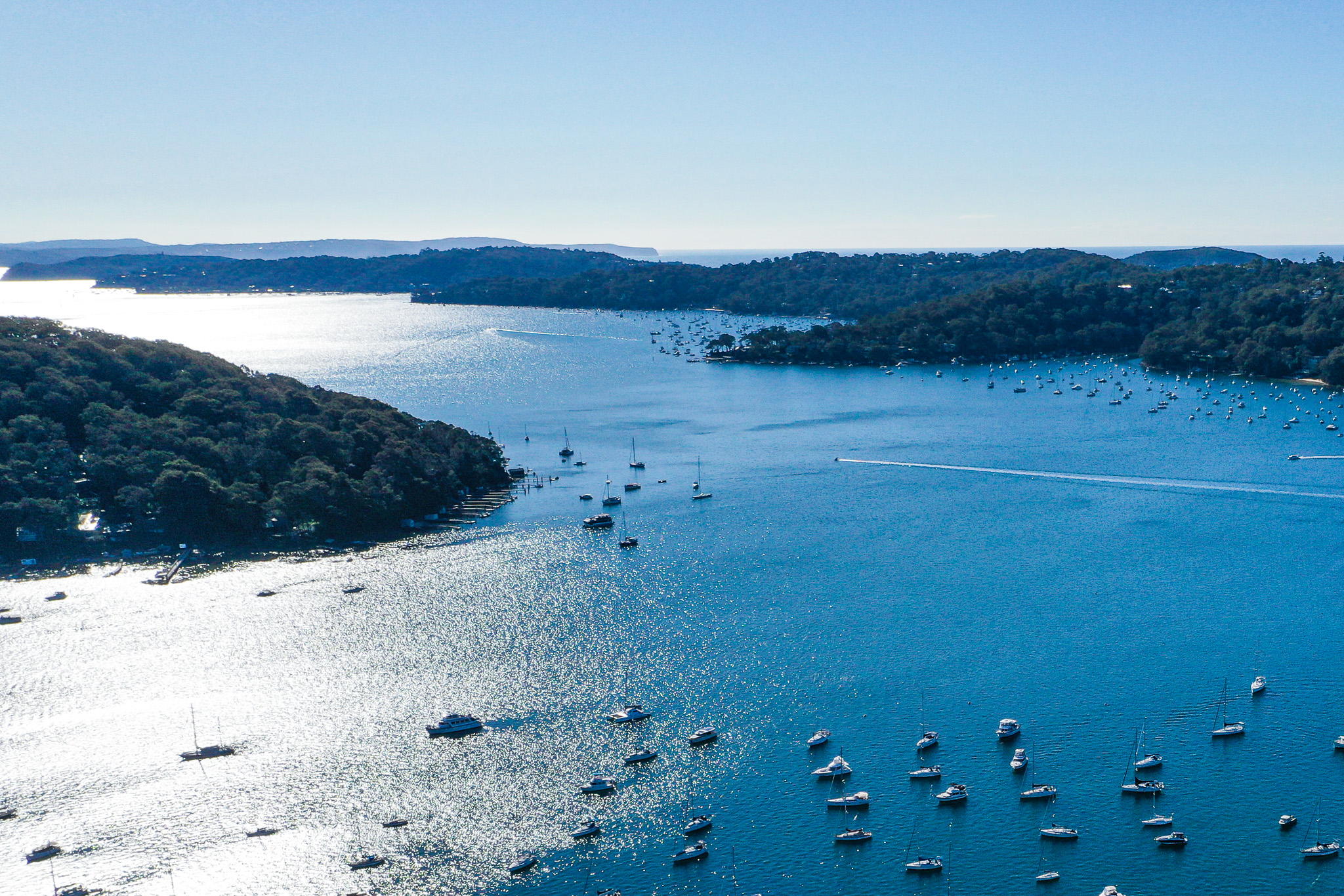
TMG Yachts Cruising Guide to Pittwater and the Hawkesbury
Surrounded by 30,000 hectares of unspoiled and spectacular Ku-ring-gai Chase National Park and only 35 km from Sydney’s CBD, Pittwater and the Hawkesbury are two of the most picturesque cruising destinations in New South Wales.